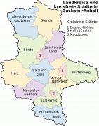
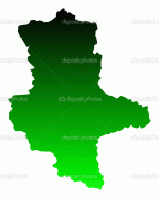
Saxony-Anhalt
 |
 |
The state of Saxony-Anhalt was formed in July 1945 after World War II, when the Soviet army administration in Allied-occupied Germany formed it from the former Prussian Province of Saxony and the Free State of Anhalt. Saxony-Anhalt became part of the German Democratic Republic in 1949, but was dissolved in 1952 during administrative reforms and its territory divided into the districts of Halle and Magdeburg. Following German reunification the state of Saxony-Anhalt was re-established in 1990 and became one of the new states of the Federal Republic of Germany.
Saxony-Anhalt is renowned for its rich cultural heritage and possesses the highest concentration of UNESCO World Heritage sites in Germany.
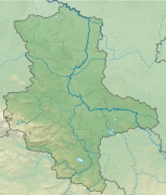
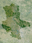
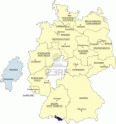
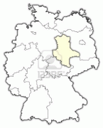
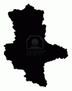
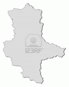
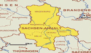
Saxony-Anhalt is one of 16 constituent states of Germany. It is located in the western part of eastern Germany. By size, it is the 8th largest state in Germany and by population, it is the 11th largest.
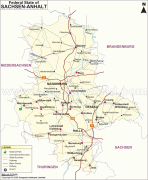
It borders four other states: Brandenburg to the north-east, Saxony to the south-east, Thuringia to the south-west and Lower Saxony to the north-west.
In the north, the Saxony-Anhalt landscape is dominated by the flat expanse of the North German Plain. The old Hanseatic towns Salzwedel, Gardelegen, Stendal and Tangermünde are located in the sparsely populated Altmark. The Colbitz-Letzlingen Heath and the Drömling near Wolfsburg mark the transition between the Altmark region and the Elbe-Börde-Heath region with its fertile, sparsely wooded Magdeburg Börde. Notable towns in the Magdeburg Börde are Haldensleben, Oschersleben (Bode), Wanzleben, Schönebeck (Elbe), Aschersleben and the capital Magdeburg, from which the Börde derives its name.
The Harz mountains are located in the south-west, comprising the Harz National Park, the Harz Foreland and Mansfeld Land. The highest mountain of the Harz (and of Northern Germany) is Brocken, with an elevation of 1,141 meters (3,735 ft). In this area, one can find the towns of Halberstadt, Wernigerode, Thale, Eisleben and Quedlinburg.
The wine-growing area Saale-Unstrut and the towns of Zeitz, Naumburg (Saale), Weißenfels and Freyburg (Unstrut) are located on the rivers Saale and Unstrut in the south of the state.
The metropolitan area of Halle (Saale) forms an agglomeration with Leipzig in Saxony. This area is known for its highly developed chemical industry (the Chemiedreieck – chemical triangle), with major production plants at Leuna, Schkopau (Buna-Werke) and Bitterfeld. Finally, in the east, Dessau-Roßlau and Wittenberg are situated on the Elbe (as is the capital Magdeburg) in the Anhalt-Wittenberg region.
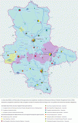
Map - Saxony-Anhalt
Map


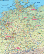
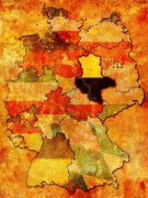

Country - Germany
 |
 |
| Flag of Germany | |
Various Germanic tribes have inhabited the northern parts of modern Germany since classical antiquity. A region named Germania was documented before AD 100. In 962, the Kingdom of Germany formed the bulk of the Holy Roman Empire. During the 16th century, northern German regions became the centre of the Protestant Reformation. Following the Napoleonic Wars and the dissolution of the Holy Roman Empire in 1806, the German Confederation was formed in 1815.
Currency / Language
| ISO | Currency | Symbol | Significant figures |
|---|---|---|---|
| EUR | Euro | € | 2 |
| ISO | Language |
|---|---|
| DE | German language |

